Summary
A great tour between three historic market towns in the Cateran Ecomuseum that provides a superb day out on two wheels or a great connection between various other routes in the Ecomuseum.
Scottish Outdoor Access Code: Know the code before you go
Please use the arrows on left/right side to go to previous/next route.
You can download our booklet, From Deep Time To Our Time, Cycling Across The Cateran Ecomuseum here.
Route stats
Suitable for: Road bikes
Total Distance: 35.9 km
Total Ascent: 290 m
Terrain: A mixture of quiet roads
Access: Fully accessible (no gates, steps or barriers)
Route Category: Straightforward
Riding Time: 2 - 3 hrs
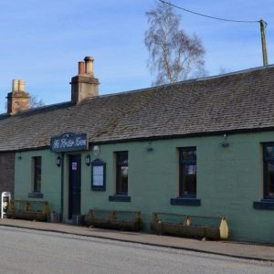
Start/Finish: Alyth Market Square
OS Grid Ref: NO 24612 48519
Nearest Parking: At the start
Key Facilities on Route: Alyth (accommodation, bike shop, shops, restaurants, cafes), Blairgowrie & Rattray (accommodation, bike shop, shops, restaurants, cafes, large supermarket) Coupar Angus (accommodation, bike shop, shops, restaurants, cafes), Ardler (pub)
OS Landranger Map: 53 (or custom Cateran Ecomuseum map)
For information on local accommodation & services click here


Route Description
Leaving Alyth on Bamff Road the route passes the Den ‘O’ Alyth before climbing steadily on a small road to the hamlet of St. Fink, where c. AD 720 there was a chapel dedicated to St. Fynoana, one of the nine virgin daughters of Saint Donevald. Shortly afterwards the road (signposted to Blairgowrie) descends into Rattray and crosses the River Ericht into Blairgowrie. There are places to stop close to the Wellmeadow, or only a short detour away. A short walk along the river to Cargill's Leap, named after the famous Covenantor, is worth the detour. From here the route follows Welton Road out of town, passing the site of the former railway station which is now a Tesco supermarket (nearby streets retain railway-themed names), and continues on quiet roads to Rosemount.
About a kilometre afterwards, Monk Myre, a kettle hole left over from the last ice age, is another great detour with its diversity of wetland birds. The route then continues to Easter Bendochy and the impressive Bendochy Kirk, situated close to the River Isla, which has been a site of worship for 900 years. Take care on the A923 into Coupar Angus, which follows the route on one of Caulfeild’s Military Roads, with Coupar Angus inviting another stop. On the way out of town the route passes the few remains of the 12th century Cistercian Abbey of Coupar Angus, before following a small road to Kettins.
From Kettins, another ancient spiritual centre, the route continues on to Ardler, where a pub invites for a final stop, before more quiet roads are followed back to Alyth.
You can also explore Alyth Auld Town and find out how this traditional market town built its success over centuries of political, economic and social change.
And by taking A Spin Along the Ericht you will discover how the fast flowing waters of the River Ericht powered Blairgowrie into becoming one of the most thriving centres in Tayside's textile industry.
Find out more about some of the key Points of Interest below.
If you enjoyed this route, why not try the following?
Points to visit
Along the way you will find these points of interest:

The Brig ‘o’ Blair
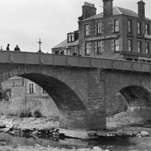
A key river crossing to Highland Scotland. The Brig o’ Blair offers a fine view of the River Ericht, one of the Ecomuseum’s main rivers. Its rapid and often turbulent water course, which descends 80 metres (262.4ft) from its headwaters at...
Read more - "The Brig ‘o’ Blair"Blairgowrie Wellmeadow
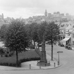
Created in the triangular space between the main routes northward and across the River Ericht, the Wellmeadow forms the principal public open space in Blairgowrie. The area was, in past times, rich in natural springs and the name Wellmeadow is...
Read more - "Blairgowrie Wellmeadow"River Ericht
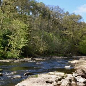
One of the Ecomuseum’s most scenic rivers. The rapid and often turbulent water course of the River Ericht is formed from the confluence of the rivers Blackwater and Ardle which join together north of Blairgowrie & Rattray at Bridge of...
Read more - "River Ericht"Cargill’s Leap
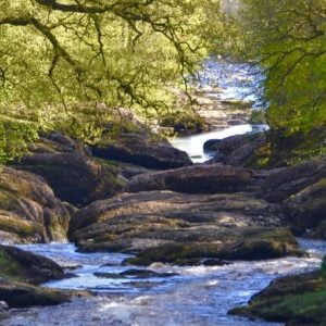
Site of a famous escape. This narrow gorge in the River Ericht just north of the Brig ‘O’ Blair was once known as the ‘Keith’ but is now commonly referred to as Cargill’s Leap. Donald Cargill, born in Rattray, was a...
Read more - "Cargill’s Leap"Coupar Grange
The site of A Medieval Monastic Farm. Just before you come to the grand Victorian buildings of present day Coupar Grange Farm, on the left hand side of the road, lie the remains of a monastic grange of Medieval date, represented by a series of...
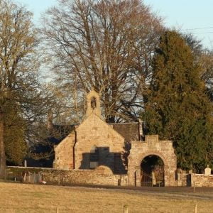
Read more - "Coupar Grange"Bendochy Kirk
A place of worship for the last 900 years.Bendochy Parish Church is one of the oldest ecclesiastic sites in Scotland, the walls of the present Church being seven hundred years old. Even earlier, in the time of the Culdees, there was a religious...
Read more - "Bendochy Kirk"Couttie Law
An imposing Neolithic Burial Mound. This round, conical, isolated hill (or ‘Law’), is also known as Hills of Bendochy Burial Mound. It is a well preserved burial mound of the Neolithic period, some 4,000 to 5,000 years old, measuring 37m in...
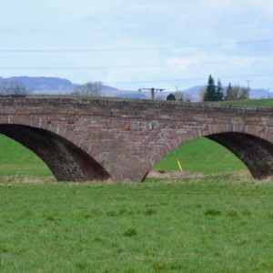
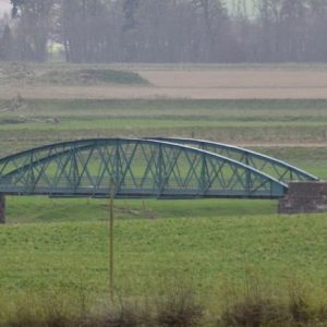
Read more - "Couttie Law"Couttie Bridge
A five-span rubble bridge with segmental arches. This rather magnificent structure spans the River Isla just north of Coupar Angus. Consisting of 5 arches with the largest in the centre, it was built in 1766 and while it is contemporary with the...
Read more - "Couttie Bridge"Coupar Angus Abbey
Site of one of Scotland’s most successful Cistercian Monasteries. Coupar Angus Abbey was a Cistercian Monastery founded in 1159 on the old Royal Manor of Coupar. King Malcolm IV (1156-65) allocated the land to the order on the advice of his uncle,...
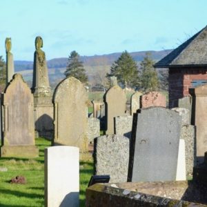
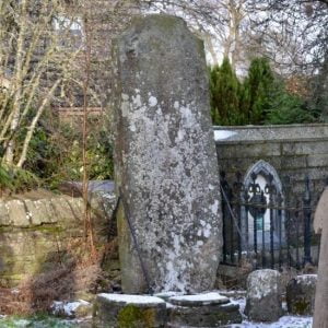
Read more - "Coupar Angus Abbey"Coupar Angus Abbey Kirkyard
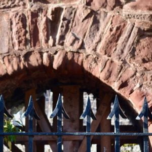
One of the Ecomuseum’s most historic churchyards. The Coupar Angus Abbey Kirkyard sits on a slight prominence in an otherwise low-lying area South of the River Isla and within a loop of its tributary, the Coupar Burn. The Gatehouse The...
Read more - "Coupar Angus Abbey Kirkyard"Kettins Cross Slab
One of the largest examples of an 8th or 9thc Pictish Symbol bearing Cross Slab. The small village of Kettins lies just across from the southern edge of the Ecomuseum. This cross-slab stands beside the northern boundary wall of Kettins church-yard,...
Read more - "Kettins Cross Slab"Kettins Kirk
Consecrated to St Brigid in 1249. The small village of Kettins lies just across from the southern edge of the Ecomuseum. Its Kirk stands on the site of a pre-Christian Druidic mound and it is probable that in the 6th & 7th centuries, a Celtic...
Read more - "Kettins Kirk"The Kettin’s Bell
This Bell, originally cast in 1519, is said to have been looted from a Belgian Monastery. The small village of Kettins lies just across from the southern edge of the Ecomuseum. The inscription on the bell, which reads “My name is Marie Troon and...
Read more - "The Kettin’s Bell"Ardler
Originally planned as a Railway Village. This small village was the brainchild of local landowner George Kinloch, who was elected as a Liberal MP for Dundee following the Scottish Reform Act of 1832. Kinloch, who was Chairman of the Dundee and...
Read more - "Ardler"Bardmony Bridge
Crowd funded through a local bazaar. This important crossing of the River Isla was built through the efforts of enterprising and community minded local farmers at the turn of the 20thc. Half the money was put up by 3 local farmers and the other half...
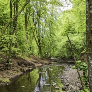
Read more - "Bardmony Bridge"Den ‘o’ Alyth
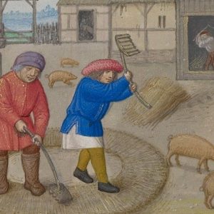
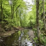
A woodland walk along part of the Highland Boundary Fault. The Den (‘narrow valley’ or ‘gorge’) o’ Alyth is a wooded glen through which the Alyth Burn runs. Part of the geography of the Highland Boundary Fault, it lies on the outskirts of...
Read more - "Den ‘o’ Alyth"