Royal Hunting
This seems to have been a good hunting area since the time of the Picts in the 8thcentury to judge by the number of hunting scenes on Pictish stones. These scenes show men on horseback chasing deer with the help of dogs. When the Scots and the Picts merged in the 9thcentury, the kings of Alba or Scotia established royal residences supported from the lands round about with food and with the services of the local tenants. This area which supported a royal residence was called a shire or a thanage. Several of these thanages were found in this area, e.g., at Strathardle, Alyth, Forfar, Kincardine and Fettercairn. There were other thanages in Strathmore but the thanages just mentioned were all probably popular hunting areas because in the 12thand 13thcenturies the kings of Scotland turned them into hunting reserves in order to protect them from the economic activities of the abbeys and of an expanding population. The Forest of Alyth is first mentioned in 1224 but had probably been created in the 12thcentury at roughly the same time as the forests of Clunie and Plater near Restenneth.
While David I (1124-1153), who was famous for founding the Scottish Border abbeys, did visit this area it was William I (1165-1214), better known as William the Lion, who spent most time in the area. He was a regular visitor to Forfar and he must have hunted in the royal forest of Plater but he also visited Clunie and Alyth. He probably also built Kincardine Park. Alexander II (1214-1249) visited Clunie and Alyth but less frequently than his father.
Hunting in the Forest of Alyth
Chasing Deer
Chasing a single deer would probably have been the most frequent sort of hunting to occur in Alyth. In open country this would involve greyhounds or deer hounds which hunted mainly by sight. The deer would be located and then chased by the same hounds throughout the hunt. The hounds were trained to work in pairs, one jumping at the rear or flanks of the deer and the other at the neck. In 1835 on Colonsay two deerhounds pulled down a stag, dislocated its forelegs, lacerated its sides and perforated its throat. In Scotland, unlike the rest of Europe, extra relays of hounds do not appear to have been set out in advance to join the chase as it proceeded, presumably because the deerhounds could last throughout the hunt. In wooded country scenting hounds or rauchs were also used to follow the game.
Driving Deer
The more prestigious type of hunt in Scotland was the drive since it involved many more people and killed far more animals. In this type of hunt the king and his nobles might join in driving the game by chasing it on horseback to the waiting hunters, as in the 14thcentury English poem, 'Sir Gawain and the Green Knight', but usually in Scotland they would wait downwind of the drive on horseback or on foot for the game to be driven towards them. Others on foot, called a stable or tinchell, drove the game towards the waiting nobles with dogs barking and horns blowing making as much noise as possible. If they were in a wooded area the king and his companions would wait out of sight of each other hidden from the deer. It they were on foot they would stand with their backs to a tree to make it harder for the deer to see them and then fire their bows or crossbows as the deer approached. If a deer was wounded dogs would be set after it to prevent it escaping. It must have taken some courage to stand and await the on-rushing game.
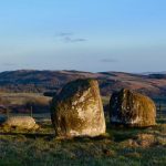
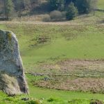
In this area of Scotland it is also possible that artificial traps were used to help to catch the game. Two elrick place-names survive around Alyth and the one in Glenisla is first recorded around 1300. An elrick was a deer trap of some sort either an enclosed circle of brushwood with one opening into which the deer were driven and then killed with arrows, spears, swords and halberds and with dogs, or it could also take the form of two banks or walls in a funnel pattern but open at the narrow end. The deer would have been driven in to the wide end and killed as they rushed through the narrow end. Sometimes, as in the tales of Fionn, the chief hunters might wait on a mound for the approaching deer.
A training for war
These hunts were seen as training for war. They required excellent horsemanship, skill with weapons and the ability to employ the available resources to best effect. They also displayed the wealth of the organisers and participants. The lord who held the hunt had to have land on which to hunt, had to have trained horses and dogs and had to own the necessary weapons. These hunts were a mark of status, identity and wealth.
They were also major events for the king and his barons. In March 1205 when William I visited Alyth, we know the names of eight barons who accompanied him, Robert de London his illegitimate son, William de Valognes the son of his chamberlain, Alexander son of Thor the sheriff of Clackmannan, Walter Murdac from Moray, Philip de Coleville who had been a hostage for William at Falaise in 1174, William Comyn a Border landholder and David Marshall. They came from various parts of Scotland and included friends, family and officials but there would have been others. Assuming that they all hunted they were joining together in a shared activity where there was more informal contact between them than in the court. The king could secure and consolidate friendships and support while the barons were honoured to hunt with the king and receive his hospitality. Apart from the shared enjoyment of their sport there would be feasting and entertainment following the conclusion of the hunt and the poorer men who formed the stable no doubt also had their own feast of venison. The king as the gift-giver was asserting his role as king but more importantly he was showing the prowess as a hunter which would have been expected of a medieval monarch.
Hunting after the middle ages
Alyth was still a royal forest in the 14thcentury but by the later 15thcentury it was held by the Lindsays who were earls of Crawford. Clunie was held by the earl of Fife in the 14thcentury and passed through royal hands to the earls of Atholl who received forest rights there from James III in 1481 and so it became a baronial forest. Coupar Angus Abbey continued to hold Glenisla which it had held as a church forest since 1233. While abbots as monks were not supposed to hunt they did so but the main value to them of forest rights would be to stop noble neighbours hunting on their land and disturbing their fields and flocks.
Drives continued to be held in the area and in the 16thcentury and probably a lot earlier, the abbot of Coupar Angus expected his tenants in Glenisla to help hunt wolves and foxes as parliament required but he also expected them to perform general hunting services which would have included forming tinchells, building elricks, carrying supplies, transporting dead game and building temporary lodges if required. These services had probably been in existence in the area since the time of the Picts.
In the sixteenth century the well known map maker Timothy Pont said that the area held ‘bestiall in abundance’ and was ideal for hunting .
Other tales of hunting in the area
These tales are unconfirmed. They are taken from Charles Ferguson’s 'Sketches of the Early History and Traditions of Strathardle its Glens’ in Transactions of Gaelic Society of Inverness.
In 1564 on her way to hunting in Glen Tilt, Mary Queen of Scots stayed at Coupar Angus and rode through Strathardle and Glenbrierchan. This seems to be based on the fact that the thirds of Coupar Angus were used to pay for her journey through Atholl to Inverness. (The revenues from the Roman Catholic church had been divided into thirds. Two thirds went to the men who held the lands after the Reformation. One third was divided between the church and the crown. The church received over half of that, three twelfths and the crown a twelfth. This was considered part of general royal revenue and the fact that Coupar Angus Abbey’s third helped to finance Mary is not proof that she stayed at Coupar Angus or travelled through Strathardle.) Mary’s location for 1 and 2 August is unknown. It is usually assumed to be Blair Atholl, but it could have been Coupar Angus. She reached Glen Tilt on the 3rd. In the Glen Tilt drive the men of Strathardle were on duty for two months driving deer and blocking Glen Loch, the pass of Beallach-na-leum and other passes leading eastwards from Glen Tilt.
In 1582 James VI held a grand royal hunt, a drive, in the hills of Atholl and Strathardle. The meeting place was the Hill of Elrick on Dirnanean Moor which was a noted hunting place. (One of the elricks mentioned above and in the Cateran Trail pamphlets.) Ferguson’s uncle knew of 12 elrig names in the area.
In 1246 Alexander II stayed in Coupar Angus and hunted in Strathardle and Clunie.
In 1317 Robert Bruce stayed at Coupar Angus and hunted in Strathardle. Traditions exist of him hunting on Pitcarmick Hill near the lake of Loch-nan-Diorrach.
In 1375 Robert II stayed in Coupar Angus abbey in winter and hunted in Strathardle and issued one charter at Glen Shee.
(The tales about James VI and Robert II seem the most likely to be true. Mary did hunt in Glen Tilt but no way were the men driving deer for two months. Local men of Atholl were called on to perform hunting services for the earl of Atholl and the same happened in Mar in 18thcentury. Men from Strathardle could have helped at the royal hunting in Glen Tilt.)
Sources: Grateful thanks to Dr John Gilbert for providing us with this text.
