Summary
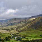
A world-class mountain bike ride on two ridges in the superb surroundings of the Southern Cairngorms National Park with 360 degree views over mountains and deep glens, and a final section through woodland past the beautiful Auchintaple Loch. Best enjoyed on clear and calm days, as the majority of the route is very exposed.
Scottish Outdoor Access Code: Know the code before you go
Please use the arrows on left/right side to go to previous/next route
You can download our booklet, From Deep Time To Our Time, Cycling Across The Cateran Ecomuseum here.
Route Stats
Suitable for: Mountain bikes (or very experienced gravel bike riders)
Total Distance: 41.9 km
Total Ascent: 1,220 m
Terrain: A mixture of landrover tracks, estate tracks, gravel roads and singletrails
Access: Some gates that can easily be opened
Route Category: Expert
Riding Time: 5 - 7 hrs
Start/Finish: Bridge of Forter
OS Grid Ref: NO 18729 64900
Nearest Parking: At the start, additional parking at Folda, Kirkton of Glenisla and Freuchies (Glenisla Forest)
Key Facilities on Route: None, but several streams for water
OS Landranger Map: 43/44 (or custom Cateran Ecomuseum map)
For information on local accommodation & services click here


Route Description
This old Droving route starts at the Bridge of Forter, north of Kirkton of Glenisla and Folda, which both provide alternative parking if needed. After a gate the route uses a landrover track on the eastern side of the River Isla, passing a few houses along the way to Linns. Here a bridge crosses the river just north of Auchavan, and after a short section through a woodland the route follows a gravel path north.
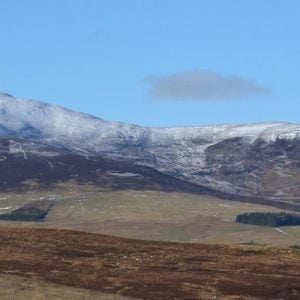
After a bridge the route follows an estate track past Tulchan Lodge and along Glenbrightly Burn and Collie Shiel Burn, with a few fords along the way. The route climbs continuously with some steep sections towards Little Glas Maol, at 973m metres the highest point of the route. The views from here into Caenlochan Glen, one of the most bio-diverse sites in Europe, are worth the effort. For those wanting to cycle the highest pass in Scotland, continue on the track instead of taking a right turn. This track leads you past Glas Maol on the Monega Pass to Cairn Claise, at an altitude of 1052m. For those not interested in more climbing (there is another ridge to come), the route follows the ridge to Monega Hill, with more breathtaking views into the glen and a 360 degree panorama view across the Cairngorm Mountains. Extra care is needed on the downhill from Monega Hill, which can be very slippery in wet conditions. The path leads back onto a gravel road to Tulchan Lodge. This loop can also be ridden separately, taking the same route as outward or the tarmac road from Auchavan back to the start.
After a bridge over the Isla (which makes an excellent lunch stop) a gravel track climbs at times steeply to The Call and on to Finarty Hill and Dun Hillocks. The views from this track are again fantastic. At Dun Hillock the route continues on the ridge southwest past Mayar and the Corrie Fee Natural Reserve (a worthwhile excursion if you make this an overnight trip). The route continues on the tops past Bawhelps and Mid Hill, and then descends past Badandun Hill.
After an abandoned quarry on the left the route joins the Cateran Trail towards Auchintaple Loch. The woodland it passes was largely clear felled, although a few trees remain. A small track on the right leads down to the loch and into a native woodland, which provides shelter and another great place for a rest. The route follows along the dam and shortly afterwards a gate is reached. The route then passes a private boat house (locked) and descends on a great gravel track with more breathtaking views back into Glenisla. For the last section the route rejoins the Cateran Trail back to the start.
Find out more about some of the key Points of Interest below.
If you enjoyed this route, why not try the following?
Points to visit
Along the way you will find these points of interest:

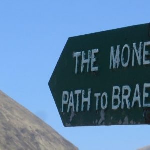
The Monega Pass
The highest of the Mounth Roads that cross the Cairngorms. The Monega Pass is the most westerly of the Mounth passes. The name ‘mounth’ being an Anglicised form of the Gaelic ‘monadh’ which translates as moor, heath or mountains and the...
Read more - "The Monega Pass"Droving across the Monega Pass
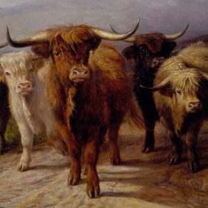
After 1707 and the Union of Parliaments, when it became easier to trade across the border, droving, the organised movement of livestock on foot to established markets and fairs, became an important feature of the Scottish economy . Haldanes map of...
Read more - "Droving across the Monega Pass"
Caenlochan Special Area of Conservation
One of the most biodiverse sites in the Ecomuseum Little Glas Maol and Monega Hill are within the Caenlochan Special Area of Conservation and its floristic richness is of European importance. It has some of the best examples in the UK of fourteen...
Read more - "Caenlochan Special Area of Conservation"Mount Blair
One of the Ecomuseum’s most prominent landmarks with superb summit views. Mount Blair’ sweeping, symmetrical cone, 744 metres high, is located between Glenshee and Glen Isla. On a clear day you have a 360 degree view encompassing...
Read more - "Mount Blair"The Glad Stane (Also known as the Gled Stane)
Thrown by a Giant? Away back in the dim and distant ages of mythology a giant named Colly Camb was reputed to have resided among the rocks on the south side of Mount Blair, where his place of abode, or “Hole,” still bears his name. Some...
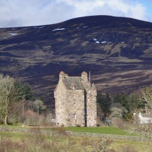
Read more - "The Glad Stane (Also known as the Gled Stane)"Forter Castle
A fine example of a late medieval Tower House. Forter Castle was built by the Ogilvys of Airlie as a fortified house in 1560. Such ‘Tower Houses’ as they are known, were intended primarily as dwellings, but constructed so that they could be made...
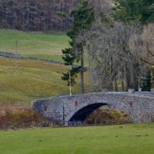
Read more - "Forter Castle"Brewlands Bridge
Built by Public Subscription in 1836. Brewlands Bridge (or Claypots Bridge) was built by public subscription in 1836. The subscriptions give a fascinating insight into the relative considered worth of the land and occupants in Glenisla at that...
Read more - "Brewlands Bridge"Kirkton of Glenisla
The heart of Glenisla. Kirkton of Glenisla is an ancient farming community and little has changed over centuries in the way the land has been managed. The remains of Bronze Age and Pictish sites, small farms, shielings, and meal mills can still be...
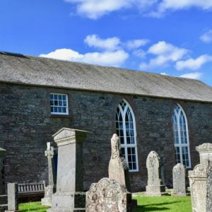
Read more - "Kirkton of Glenisla"Glenisla Kirk
A popular wedding venue. The present church was built in 1821 replacing an older church known as The Blessed Virgin. This medieval church or chapel was located on the same site now occupied by the present church. It was dedicated to the Blessed...
Read more - "Glenisla Kirk"The Kirkton of Glenisla Lady Well
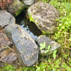
Site of an ancient well. The adjacent church is dedicated to the Virgin Mary, implying a very feminine presence on this site, including this well. In Celtic times, wells, particularly those for the goddess Bridhe, would have played an important part...
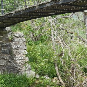
Read more - "The Kirkton of Glenisla Lady Well"Brackny Bridge
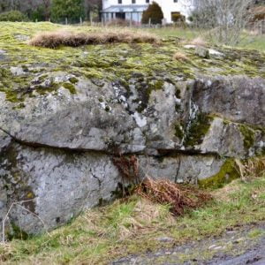
The oldest known bridge of its type in Scotland. Built in 1824 by engineer John Justice of Dundee as a prototype for a larger version at the Haughs of Drimmie, this bridge has a span of 19 metres and a sheep gate at one end. It is the oldest known...
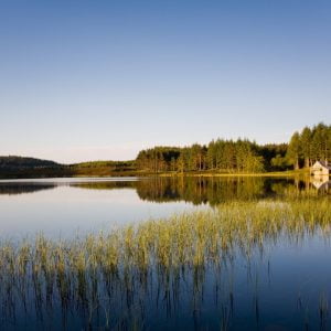
Read more - "Brackny Bridge"Auchintaple Loch
Auchintaple Loch, which has a boat house on the far side, is often named as a favourite spot by walkers on the Cateran Trail. Whilst the loch itself is man-made there are traces of an early chapel at Chapel Hillock on a low rise just above the loch,...
Read more - "Auchintaple Loch"