A walk through stunning landscapes shaped over 400 million years ago
This geotour, which will take you around an hour, starts on the north side of the Hill of Alyth, where the Cateran Trail crosses the road. There is limited parking just to the east or by the cattle grid at the bottom of Balwhyme Farm.
Details of the route can be found on the map below (north west corner).
Walk up the steep path. After about 350m at NO22975040, red conglomerate is exposed in the path, with thin sandstone interbeds dipping steeply south. Similar rocks form the many small crags on the hill.
-3-25762
56-63934

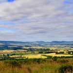
At the first Cateran Trail waymarker post bear slightly right and up hill. Turn left (east) at the second post. At the third post NO23075031 there is a good view westwards along the Den of Welton, the trace of the Highland Boundary Fault.
-3-25578
56-63833

Just before the fourth post bear left, leaving a small marshy patch on your right, and go round the head of a small northwest-facing valley. Near the top of the far slope at NO23555039 there is a large grey boulder. The boulder is a glacial erratic, a distinctive foliated grey-white granite which occurs only on Ben Vuirich, a hill 20 miles/32 km away to the northwest. A small patch of conglomerate bedrock is exposed near its base.
-3-24809
56-63907

On the west side of the valley, small crags expose more conglomerate. The pebbles are well rounded, reflecting a long period of transport by water. The valley itself is the trace of a small NW-SE fault (visible in the shaded-relief map on page 3).
-3-24894
-56-63886

Return by the outward route.