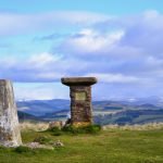
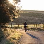
Summary
An all day gravel adventure through the heart of the Cateran Ecomuseum with great views of mountains, quiet lochs, old castles and a breathtaking waterfall.
Scottish Outdoor Access Code: Know the code before you go
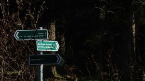
Please use the arrows on left/right side to go to previous/next route.
You can download our booklet, From Deep Time To Our Time, Cycling Across The Cateran Ecomuseum here.
Route Stats
Suitable for: Gravel bikes (we recommend at least 39mm wide tires)
Total Distance: 63.7 km
Total Ascent: 860 m
Terrain: A mixture of forest tracks, landrover tracks, quiet roads and singletrails
Access: Some gates that can easily be opened
Route Category: Expert
Riding Time: 6 - 8 hrs
Start/Finish: Freuchies Car Park
OS Grid Ref: NO 22424 60801
Nearest Parking: At the start, additional parking at Kirkton of Glenisla (alternative start)
Key Facilities on Route: Peel (cafe & farm shop), Kirkton of Glenisla (hotel)
OS Landranger Map: 44/53 (or custom Cateran Ecomuseum map)
For information on local accommodation & services click here


Route Description
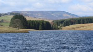
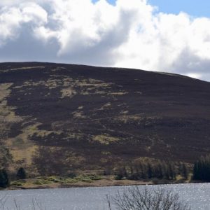
The route begins in Freuchies near Kirkton of Glenisla and follows a wide gravel path through the extensive Glenisla Forest to Glenmarkie Lodge. A path north of the lodge leads you into the open landscape. Pushing the bike may be necessary here as this gets very boggy. Shortly afterwards the route continues on another wide gravel track that leads south past an abandoned house in Barny to Backwater Reservoir. A quiet tarmac road with picnic places along the way leads to the dam. From the end of the reservoir the route follows quiet and picturesque roads to Balintore Castle, which can be seen from a good distance, located on the moorland above a small village.
Shortly before Knowhead the route follows a gravel path on the right-hand side through beautiful, open hilly landscapes, past an abandoned homestead. If you are in a hurry, you can take the gravel road to Braes of Coul as a shortcut. Continue along the periphery of Kinclune Hill before continuing on quiet roads to Woodside Cottage, from where a smooth gravel path leads through the woods to West Campsie. Shortly afterwards the route reaches the wildlife reserve Loch of Lintrathen. Peel Farm on the southern end of the loch is a great coffee stop, and the route continues on quiet roads to Bridge of Craigisla. The stunning Reekie Linn waterfall is just a short walk away.
From here a small road leads past Broom Hill to Brewlands, with a wonderful view of the mountains of the Southern Cairngorms National Park. From Brewlands the route follows a small road towards Folda and takes a dirt road to the right towards Auchintaple Loch. The route follows the Cateran Trail to Loch Shandra and on to the hotel in Kirkton of Glenisla, a great final stop before the route ends in the parking area in Freuchies.
Find out more about some of the key Points of Interest below.
If you enjoyed this route, why not try the following?
Points to visit
Along the way you will find these points of interest:

Kirkton of Glenisla
The heart of Glenisla. Kirkton of Glenisla is an ancient farming community and little has changed over centuries in the way the land has been managed. The remains of Bronze Age and Pictish sites, small farms, shielings, and meal mills can still be...
Read more - "Kirkton of Glenisla"Glenisla Kirk
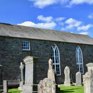
A popular wedding venue. The present church was built in 1821 replacing an older church known as The Blessed Virgin. This medieval church or chapel was located on the same site now occupied by the present church. It was dedicated to the Blessed...
Read more - "Glenisla Kirk"The Kirkton of Glenisla Lady Well
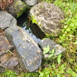
Site of an ancient well. The adjacent church is dedicated to the Virgin Mary, implying a very feminine presence on this site, including this well. In Celtic times, wells, particularly those for the goddess Bridhe, would have played an important part...
Read more - "The Kirkton of Glenisla Lady Well"Backwater Dam
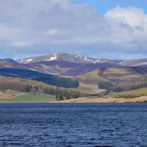
A beautiful stretch of open water. This reservoir holds the main supply of water for Angus and Dundee, Coupar Angus and Blairgowrie. From here it is piped to the treatment works at Lintrathen and then onwards to the final destinations. Built in the...
Read more - "Backwater Dam"
Glenisla Forest
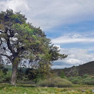
A classic example of a Forest grown for timber. Glenisla is a highly productive forest and has a proven record of growing quality timber. Planting began here in the 1949 with Sitka Spruce being the main species grown because it grows quickly and...
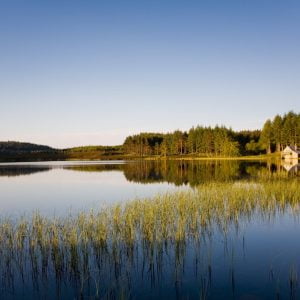
Read more - "Glenisla Forest"Auchintaple Loch
Auchintaple Loch, which has a boat house on the far side, is often named as a favourite spot by walkers on the Cateran Trail. Whilst the loch itself is man-made there are traces of an early chapel at Chapel Hillock on a low rise just above the loch,...
Read more - "Auchintaple Loch"Loch Shandra
A popular fishing loch. This man-made loch, formed by the damming of the burn that runs down the glen, offers flyfishing for wild brown and rainbow trout. The name possibly means ‘Old farmtoun, settlement from the Scottish Gaelic name for this...
Read more - "Loch Shandra"Cairn Motherie & Cairn Plew
Two prehistoric burial mounds. Cairn Motherie lies in rough pasture at around 490m close to the summit of Creigh Hill. It comprises a stony cairn some 13m in diameter by 1.2m high. Despite some modifications to the surface to create small modern...
Read more - "Cairn Motherie & Cairn Plew"